Historic Center & Pelourinho
A full walking guide to Salvador's Historic Center, from Sao Bento and Rua Chile through Pelourinho, Carmo and Santo Antonio Alem do Carmo, with history, food stops and a sunset finish.
Editorial team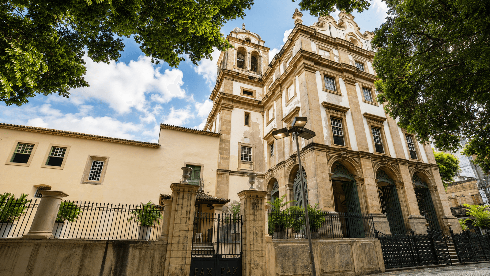
Pelourinho is Salvador's best-known historic district, but it is not the whole Historic Center. The protected historic area stretches through several sectors of the upper city, including Sao Bento, Rua Chile, the civic core around Praca Municipal, Se, Pelourinho, Carmo and Santo Antonio Alem do Carmo. For a first visit, that distinction matters: the most rewarding walk is not a loop around one photographed square, but a gradual crossing of the old city.
The city that grew on two levels
Salvador was founded in 1549 as the seat of Portugal's Governor-General in Brazil and remained the colonial capital until 1763. The escarpment above the Baia de Todos-os-Santos shaped the city from the beginning: administration, religion, defence and much residential life concentrated in Cidade Alta, while the port, warehouses and maritime commerce developed below in Cidade Baixa. Lifts, inclined planes and steep streets still connect those two levels today.
The beauty of this landscape cannot be separated from the history that produced it. Salvador was a major Atlantic slave-trade port and its churches, palaces and commercial wealth belonged to a colonial society deeply dependent on enslaved labour. At the same time, Africans and their descendants reshaped the city through religion, music, food, social organisation and resistance. That tension is central to understanding the Historic Center, which UNESCO listed as World Heritage in 1985.
Historic Center, Pelourinho or Centro Antigo?
- Historic Center: the protected historic ensemble, much larger than Pelourinho.
- Pelourinho: originally the Largo do Pelourinho; today the name is often used more loosely for the main tourist core around Terreiro de Jesus, Sao Francisco and nearby streets.
- Centro Antigo: a broader planning and heritage area that includes the Historic Center and neighbouring districts.
Start at São Bento - before entering the old city
The Monastery of Sao Bento is more than a convenient starting point. Founded in 1582, it was the first Benedictine foundation in the New World and stood south of Salvador's original fortified core, in an area that helped mark the city's expansion beyond its first walls. Its complex includes the Basilica of Sao Sebastiao and important artistic, documentary and bibliographic collections. During the Dutch occupation of Salvador in 1624, the monastery was also used by the occupying forces.
Praça Castro Alves and Rua Chile
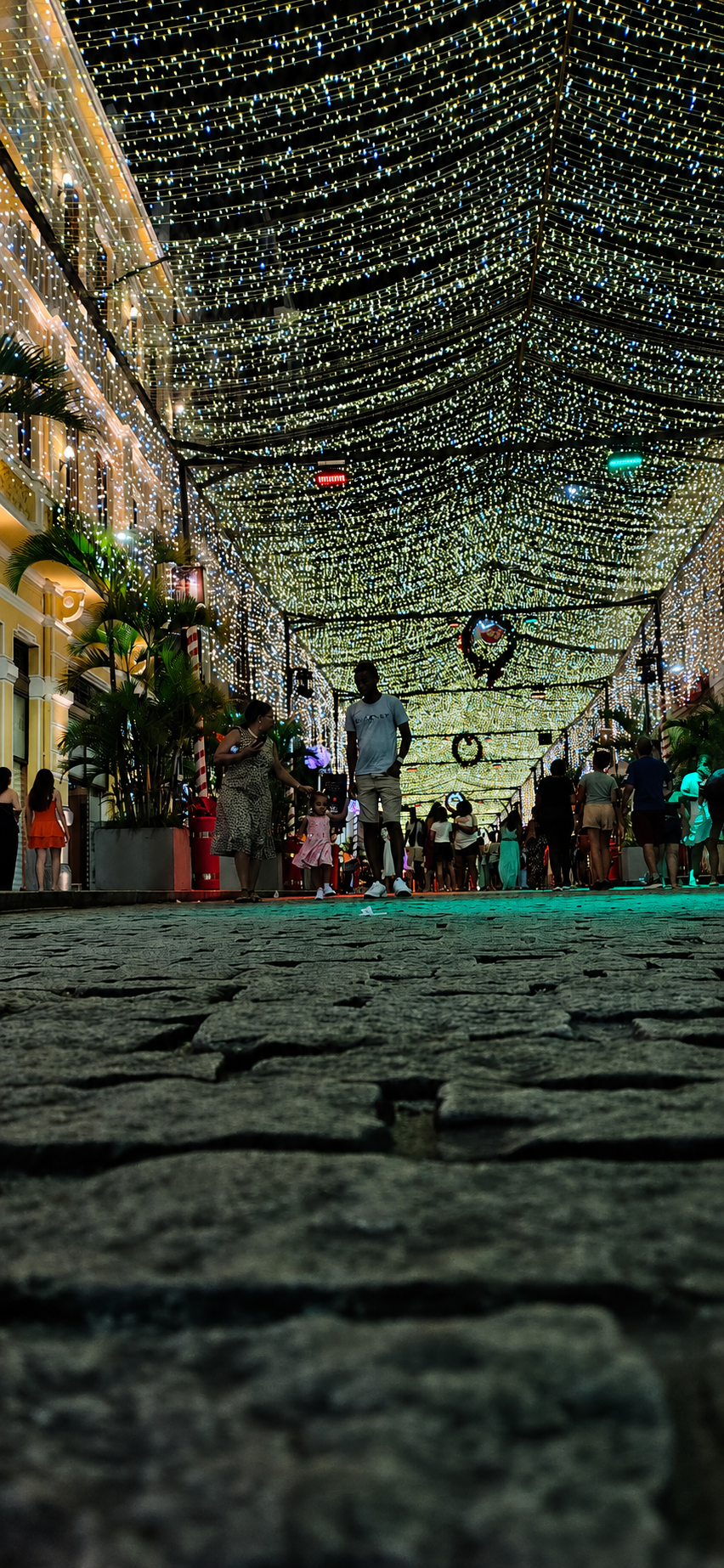
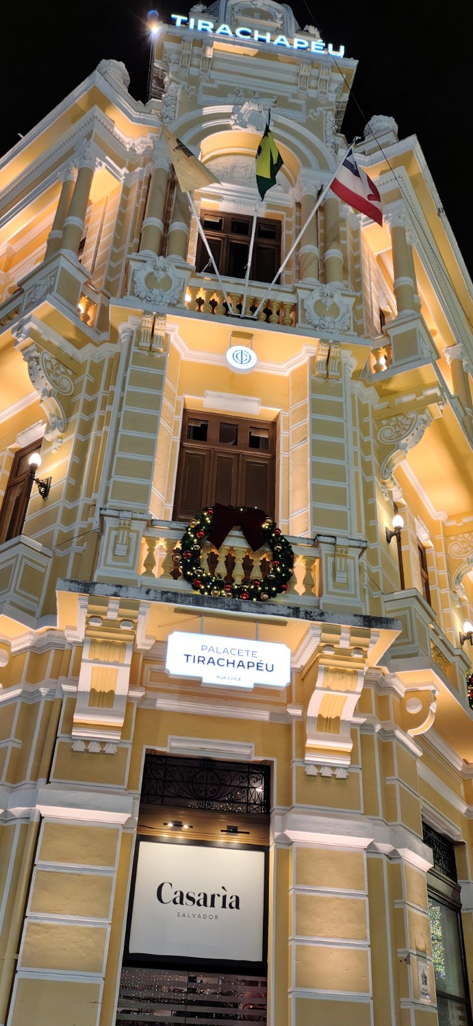
From Sao Bento, continue towards Praca Castro Alves and Rua Chile. Praca Castro Alves was once home to the Theatro Sao Joao, an important cultural venue in 19th-century Salvador. Rua Chile follows one of the main axes of the city's original 1549 street plan and is often described as Brazil's first urban street. Over the centuries it carried names linked to the city gates, merchants and the Governor's Palace before receiving its current name in the early 20th century.
Long before Salvador had shopping malls, Rua Chile was where part of the city came to shop, meet, stroll and be seen. Its hotels, elegant shops, cafes, cinemas and services made it a symbol of urban modernity. Later, as Salvador expanded and commercial activity moved elsewhere, the street lost centrality and entered a long period of decline. Today it is again one of the clearest places to observe the Historic Center's cycle of restoration, new hotels, gastronomy, cultural venues and public events.
Praça Municipal: the civic heart
Praca Tome de Sousa, usually called Praca Municipal, has been tied to political power since Salvador's earliest years. Today the City Hall, Camara Municipal, Palacio Rio Branco and Elevador Lacerda make it an obvious landmark, but the square matters because it helps explain how the upper administrative city related to the port below. The view over Cidade Baixa turns Salvador's unusual two-level geography into something immediately legible.
Sé, Terreiro de Jesus and São Francisco
From Praca Municipal, continue through Praca da Se to Terreiro de Jesus. This is where the religious and monumental density becomes unmistakable: the Catedral Basilica, the Igreja e Convento de Sao Francisco and the Ordem Terceira de Sao Francisco are among the essential landmarks. It is also the transition into the area most visitors casually call Pelourinho.
Pelourinho: the famous heart
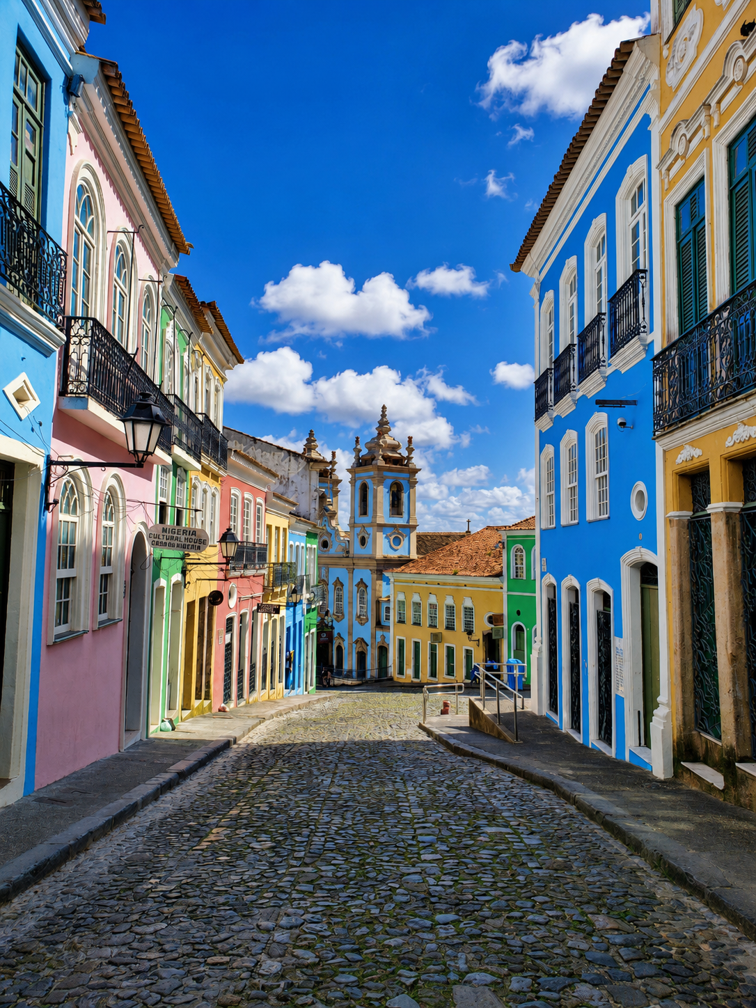
Pelourinho deserves time rather than a quick photograph. Churches, museums, cultural institutions, music, studios, shops and street life overlap here. The district is beautiful, but reducing it to colourful facades strips away the harder and more important story: colonial power, slavery, Black Catholic brotherhoods, Afro-Brazilian resistance, urban abandonment, restoration and tourism all shaped this same space.
Igreja do Passo: where the rhythm changes
On the way towards Carmo, stop at the 18th-century Igreja do Santissimo Sacramento da Rua do Passo. Its monumental staircase became internationally recognisable through the 1962 Brazilian film O Pagador de Promessas, winner of the Palme d'Or at Cannes. The steps are still part of local life: cultural events take place there, and Salvador graduation groups also use them for photographs. It is a useful reminder that the Historic Center is not a frozen museum set.
Carmo: pause and look at the bay
Beyond the Passo, the atmosphere becomes progressively more residential. Carmo is an excellent place to slow down before the final stretch, with historic houses and several cafes, bars and restaurants overlooking the Baia de Todos-os-Santos. Cafelier is one well-known option for coffee, dessert or a relaxed break with a view, but it is not the only one; choosing according to your mood and the tables available works better than building the whole day around a single venue.
Santo Antônio Além do Carmo: the right ending
The name is almost a set of directions. Santo Antonio developed beyond the Carmo, outside the limits of the earlier fortified city. Around Cruz do Pascoal, Boqueirao and Rua Direita de Santo Antonio, the Historic Center feels less monumental and more lived-in: historic facades coexist with homes, studios, small businesses, cafes, bars and restaurants. End around Largo de Santo Antonio and the Forte da Capoeira, an old defensive structure that later became strongly associated with one of Bahia's most important Afro-Brazilian cultural traditions.
A Historic Center in transformation
Salvador's Historic Center is going through another urban cycle. Public works and private investment have restored streets, squares, cultural facilities and historic buildings, particularly around Rua Chile and the main visitor corridors. That does not mean the entire historic area has been completely revitalised: restored and busy stretches still coexist with underused or degraded properties. The process is visible, active and unfinished, which is itself part of the contemporary story of the district.
Salvador Insider walk: a first full day
- Around 10:00 - begin at Mosteiro de Sao Bento, then continue to Praca Castro Alves and Rua Chile.
- Late morning - Praca Municipal, Praca da Se, Terreiro de Jesus and Sao Francisco, with time to enter the places that interest you rather than racing through them.
- 12:30-13:30 - lunch at Restaurante Escola SENAC Pelourinho, a practical way to encounter several Bahian preparations in one meal.
- 13:30-15:30 - Pelourinho at a slower pace: churches, museums, cultural spaces, streets and an optional ice-cream stop at Le Glacier Laporte.
- 15:30-16:30 - Igreja do Passo and the climb towards Carmo.
- Around 16:30 - coffee, dessert or a drink with a bay view at Cafelier or another panoramic option in Carmo/Santo Antonio.
- Final hour before sunset - Cruz do Pascoal, Boqueirao and Santo Antonio Alem do Carmo, finishing around Largo de Santo Antonio and the Forte da Capoeira.
A different option: Carmo & Santo Antônio after 5 pm
Treat the evening version as a separate outing, not as compulsory overtime after the full-day walk. Come back on another day around 17:00, start in Carmo, move slowly towards Santo Antonio, stop for coffee, a drink or a snack, catch sunset and then stay for dinner, bars and the neighbourhood's evening atmosphere. Friday and Saturday are usually the best bets if you want a livelier night.
Before you go
- Wear light clothing and comfortable shoes: cobbles, slopes and stairs make this a real walking day.
- Carry water and use sun protection. Salvador's heat does not care how carefully you planned your outfit.
- Confirm current opening hours for churches, museums, lifts and restaurants; services, restoration work and weekly closing days can change the plan.
- If you want deeper historical context, a good local guide adds enormous value, but this route is also structured to make sense for an independent first visit.
Related reading

Afro-Brazilian Salvador
The museums, institutions and living practices that explain the city better than any postcard.
Read guide
Museums & Culture
A short, curated list — quality over quantity, with the context each place gives you.
Read guide